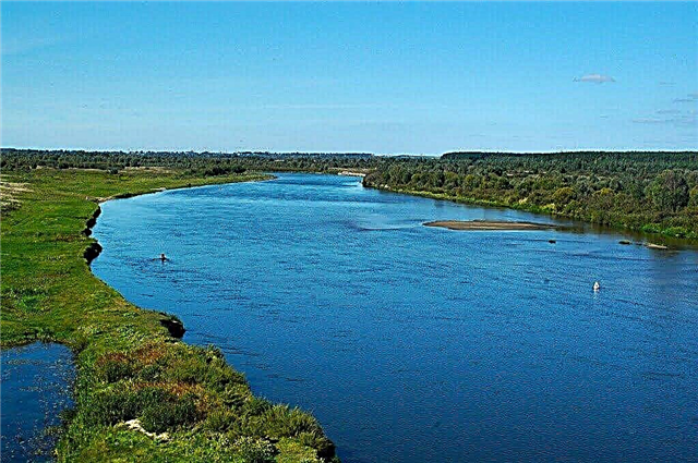
Belarus is a country at the crossroads of Western and Eastern Europe. The local water network is used very actively: Belarus has no access to the sea, therefore it is trying to develop recreational tourism at the existing natural sites. Recreation centers, areas for sports and amateur fishing, tourist routes for hiking and kayaking are emerging. An example of this is the Obol and Drissa rivers.
Problems often arise with the etymology of the names of reservoirs. Although there are exceptions, like the Beaver River: there are many settlements of these animals in the district, hence the name. If nothing threatens the beavers here, in other places the economic activity of people affected the population. So in Zelvyanka, reclamation work destroyed their livestock.
The longest rivers in Belarus
List of the largest rivers flowing in the country.
Dnieper
The fourth largest river in Europe. In some places the Dnieper acts as a state border. For the most part, the river is navigable. In the past, it was used more actively, including for passenger traffic. Currently, only cruise ships and security boats operate on some sites. There are about 50 species of fish, the most remarkable is the needle fish.
The length of the river is 2201 km, in Belarus - 595 km.

Western Dvina
Belongs to Russia, Latvia and Belarus. In the past, the names of the Western Dvina have changed. In Latvia it is called the Daugava. It was connected by a channel with the Dnieper, but now it is not used. Three hydroelectric power plants have been built on the river. There are dozens of cities on the coast, including Vitebsk. Above it is a 12-kilometer stretch of rapids.
The length of the river is 1020 km, in Belarus - 328 km.

Neman
It flows through the territory of three countries. Serves as the state border between Lithuania and Russia. It begins on the slopes of the Minsk Upland and flows into the Curonian Lagoon. A popular entertainment among tourists is walking along the Neman on a motor ship. Also, barges with sand and timber supervise along the channel. Several hydroelectric power plants have been built on the river, including the Grodno one.
The length of the river is 937 km, in Belarus - 459 km.

Pripyat
One of the largest tributaries of the Dnieper. Of these, 500 km belong to the territory of Belarus, the rest - to Ukraine. The high water is long, which is explained by the mixed feeding with a predominance of snow. The river is not only navigable, but also actively used for timber rafting. Fishing is developed, both amateur and sports, and industrial. There is a large pond-type fish farm.
The length of the river is 775 km, in Belarus - 500 km.

Western Bug
Also applies to the lands of Poland and Ukraine. Some sections of the channel run directly along the state border. It is also the eastern border of the EU. Through the channel the Western Bug connects with the Dnieper. Conventionally, the river divides the Catholic and Orthodox peoples. Here was the line of demarcation between the USSR and Germany after the Nazi invasion of Poland.
The length of the river is 772 km, in Belarus - 154 km.

Sozh
The left tributary of the Dnieper, belonging to the territory of three countries. Navigable about half the length of the channel. The gateway system worked in the past. But it was destroyed during the Great Patriotic War and was never restored. On the coast there are large settlements, including the city of Gomel. Near it, the waters of the Sozh are the cleanest, in general the river is one of the cleanest in Europe.
The length of the river is 648 km, in Belarus - 493 km.

Berezina
Right tributary of the Dnieper. The longest river, which along its entire course is located in Belarus. It originates in a swampy area. It covers 4 regions and crosses almost the entire country. The river went down in history when a major battle took place here during the war of 1812. One of the folk songs of Switzerland is even dedicated to the Berezina: the soldiers of this state took part in the battle on the side of Napoleon.
The length of the river is 613 km.

Viliya
It also flows in Lithuania. There the river is called Nyaris. The largest artificial reservoir in the country, the Vileika reservoir, is located on the river. From here Minsk is supplied with drinking water. The shores are full of tourists during the season. The area is popular with kayakers; regular routes for tourist groups have been developed.
The length of the river is 510 km, in Belarus - 276 km.

Bird
Left tributary of the Pripyat. Bird floods in spring. It is known for its large reservoir - Volchkovichsky. Amateur fishing on the river is allowed, but spearfishing is prohibited. Along the banks you can find many parking areas, there are also those where a campfire and tent site is already equipped. The Petrikovsky hunter's house is also worth a visit.
The length of the river is 421 km.

Svisloch
It enters the Dnieper basin and is a tributary of the Berezina. It originates near Mount Mayak. On the river is the capital of Belarus - the city of Minsk. Within its limits, various works were carried out with the channel: it was expanded, some areas were filled up, and taken to the side. In this area, the water is polluted and is practically not used. Recreation areas are organized in the upper reaches of the river.
The length of the river is 327 km.

Shchara
It flows out of Lake Koldychevskoe. The name can be translated from Finno-Ugric as "channel" or "stream". The Minichi reservoir was built, the water level is controlled by locks in the lower and middle reaches. There is a tourist base of the same name on the river. People come here for pike, roach, burbot. The winding riverbed creates good places for kayaking.
The length of the river is 325 km.

Drut
Right tributary of the Dnieper. The estuary is located near the town of Rogachev. The banks are steep and winding, mostly covered with forest. High flood is characteristic - more noticeable than in other water bodies of the region. The Chigirinskoye reservoir was built, below it Drut 'becomes navigable. There are several zones and recreation centers, including "Luzhki", "Chigirinka", "Malina" and the river of the same name.
The length of the river is 295 km.

Clean up
The right tributary of the Pripyat. It originates in the lands of Ukraine. The channel is winding and very heterogeneous: its width varies from 10 to 60 meters. During the season, kayakers and amateur fishermen meet on the river. The catch of the latter consists mainly of rudd, pike, ide. Recreation areas are scattered along the shores, including sandy beaches.
The length of the river is 292 km, in Belarus - 126 km.

Conversation
Belongs to Russia and Belarus. It crosses the border of two states several times. It flows into the Sozh River, becoming its left tributary. When traveling to this area, it is better to take a radiation measuring device with you. Part of the territory is located in the resettlement zone after the Chernobyl disaster. There is no permanent population in the district, but in the floodplain the radiation indicators are within normal limits.
The length of the river is 261 km., In Belarus - 185 km.

Yaselda
The left tributary of the Pripyat, which flows in the Brest region. Significant depth differences occur along the entire length. The floodplain is occupied by the Selets reservoir. About a quarter of the channel is canalized. Fishermen come here for pike. For the middle course, the largest individuals are characteristic, reaching 6 kg. The forests along the banks are rich in gifts of nature, during the season there are many mushroom pickers.
The length of the river is 250 km.

Case
Left tributary of the Pripyat. The large city of Slutsk is located on the river. There are opportunities for ecotourism in the area. Hunting is also permitted here at certain times of the year. There are many waterfowl, hares and larger targets like wild boars and elks. The fishing is varied, the bite is good. Restrictions apply in a number of areas and certain types of fishing are prohibited.
The length of the river is 228 km.

Berezina
Sometimes it is called the Western Berezina, so as not to be confused with another river with a similar name. The right tributary of the Neman, which flows in the Grodno and Minsk regions. The Sakovschinskoe reservoir and hydroelectric power station were built. It has an extensive network of tributaries, which are mostly canalized. The area around is divided into three zones: flat, swampy and forested.
The length of the river is 226 km.

Drissa
It flows exclusively within the Vitebsk region. It belongs to the right tributaries of the Western Dvina. The river valley is very swampy, and the banks are partially covered with reeds. The area will appeal to fans of ecotourism. Travel agencies offer hiking trails here for several days. In 2011, Drissa made the news: a wooden idol was found at the bottom. However, it turned out to be a fake.
The length of the river is 183 km.

Disna
It flows out of the Lithuanian Lake Disnay. It reaches its greatest width in the middle course. Experienced athletes choose the river for training: they can be rafted in kayaks and kayaks. Since the winding channel is replete with shoals, rifts, in places it is blocked by fallen trees, such hikes are not suitable for beginners.
The length of the river is 178 km, in Belarus - 149 km.

Pronya
Refers to the Mogilev and Vitebsk regions. It is a right tributary of the Sozh. The river has a slow current and gentle banks. This is due to its earlier freezing - already in November. It often spills both in the spring after the ice has melted and in the summer. The strategic position of the reservoir led to a tough confrontation in this area between Soviet and German troops during the Great Patriotic War.
The length of the river is 172 km.

Zelvyanka
The left tributary of the Neman flows in the Brest and Grodno regions. The floodplain of the river is swampy. There are large swamps Zhuravlinye and Bagna-Skheda. A small hydroelectric power station was built under the name Papernya. Reclamation works have almost completely destroyed the livestock of beavers, burbots and crayfish. On the shores you can see muskrats and otters. There are comfortable fishing spots with good bite.
The length of the river is 170 km.

Doe
The right tributary of the Pripyat, flowing in the Minsk and Brest regions. In the river valley, there are mixed forests and swampy areas. It is almost completely canalized, and the water level in the channel is regulated by the Loktyshi reservoir. On the coast there are architectural monuments, for example, the manor of the XIX-XX centuries in the village of Yanovichi or the church of the XIX century in the town of Kletsk.
The length of the river is 161 km.

Oressa
The right tributary of the Ptichi, flowing in the Minsk and Gomel regions. In the lower course it passes through the Pripyat Polesie, where a complex of reclamation canals has been created. The width of the river in the lower reaches is three times greater than in the upper. Oresse has excellent bite. The river became famous thanks to the poem by Yanka Kupala, written after numerous visits to this area.
The length of the river is 151 km.

Moroch
Refers to the Minsk region. At the beginning of the last century, the border between the Soviet Union and Poland ran along the river. In the past, Moroch was known as Copanka. In our time, the river has changed: reclamation work has been carried out, the channel has been canalized. From this ice is released in March in about a week. The flood begins rapidly, the river floods strongly.
The length of the river is 150 km.

Obol
It flows in the Vitebsk region. The Klyuchegorsk reservoir was built, as well as the hydroelectric power station of the same name, which is currently not in use. The Oboli runs are steep, there are peat bogs and impenetrable forest areas. Near the village of Kiseli, on the left bank, there is an archaeological site - a settlement dating back to the 7th-10th centuries. The area is popular with tourists.
The length of the river is 148 km.

Tsna
Belongs to the Brest region and is a left tributary of the Pripyat. It originates in a swampy area and flows along the Pripyat Polesie. The name comes from the word translated as "quiet". Moreover, the etymology of other rivers with the same name is different. Technical facilities for wastewater treatment have been installed at Tsna. They occupy a little less than half of the length of the river.
The length of the river is 126 km.

Beaver
The left tributary of the Berezina flowing into the Vitebsk and Minsk regions. The name was given because of the large number of beaver settlements. In the swampy and uneven floodplain, there are reclamation channels. The banks are steep and steep, and the channel is winding, smooth bends abound. It is covered with ice in December and opens up in March. There are numerous settlements on the river.
The length of the river is 124 km.

Ulla
It flows in the Vitebsk region, is a left tributary of the Western Dvina. It originates from Lake Lepel. There is debate about the origin of the name, it probably came from the words translated as "forest stream" and "wet". The river got to the pages of the chronicles thanks to the battle of 1564 during the Livonian War. Here Pyotr Shuisky, the governor and statesman, laid down his head.
The length of the river is 123 km.

Ushacha
Left tributary of the Western Dvina. It originates in the Berezinsky Biosphere Reserve. One of the features is the flow through several lakes. The fish species are typical for the region, but for amateur bird watchers there is an interesting object to observe - the blue kingfisher. There are archaeological sites along the river bed, as well as a 19th century-style park near the village of Rudnya.
The length of the river is 118 km.

Vortex
Geographically, it refers not only to Belarus, but also to Russia. The name comes from the words whirlwind and whirlwind, as the channel is very winding. The river is famous for two major battles. The first is dated 1386. Then the confrontation unfolded for the Mstislavsky principality between the Lithuanians and the Russians. And in 1708, one of the battles of the Northern War took place here.
The length of the river is 118 km.


